We use computer vision algorithms to characterize rock properties using 2D and 3D imaging.

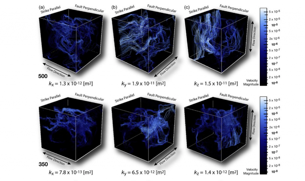
Fault zone permeability and the real 3D-spatial distribution of the fault-related fracture networks are critical in the assessment of fault zones behavior for fluids. The study of the real 3D-spatial distribution of the microfracture network, using X-ray micro-computed tomography, is a crucial factor to unravel the real structural permeability conditions of a fault-zone. Despite the availability of several commercial software for rock properties estimation from X-ray micro-computed tomography scanning, their high cost and lack of programmability encourage the use of open-source data treatment. This work presents the implementation of a methodology flow for the quantification of both structural and geometrical parameters (fractures density, fractures aperture, fractures porosity, and fractures surface area), and the modeling of palaeopermeability of fault-related fractured samples, with focus in the proper spatial orientation of both the sample and the results. This is performed with an easy to follow step-by-step implementation, by a combination of open-source software, newly implemented codes, and numerical methods. This approach keeps track of the sample’s spatial orientation from the physical to the virtual world, thus assessing any fault-related palaeopermeability anisotropy
Palaeopermeability anisotropy and geometrical properties of sealed-microfractures from micro-CT analyses: An open-source implementation. Gomila, R.; Bracke, R.; Arancibia, G.; Mery, D.; Morata, D.; and Nehler, M. Micron, 2019.